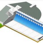
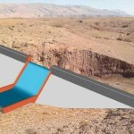
Main features of the work:
• catchment km² 103.67;
• maximum stored volume m³ 7,808,360;
• crest length m 330,00, 10,00 m wide;
• maximum height from the crest to the clay core base 46.00 meters;
• slopes: upstream face 1V : 3H, downstream face 1V : 2,75H with three berms
2,00 m wide;
• excavation volume for cofferdam, dam, bottom outlet and spillway 500,000 m³;
• volume of the dam body including the cofferdam, clay core and shells
1,100,000 m³;
• concrete for bottom outlet, spillway and various works 12,000 m³;
• buildings and security guard services 800.00 m².
03 Giu 2014
Comments: 0

03 Giu 2014
Zalan is a concrete dam. Its typical cross section can be described as follows:
• Height of the Dam: 24.50 m from river bottom at dam axis;
• Stream Bed Level: 915.00 m a.s.l.;
• Width of the valley at the Dam site: about 30 m at the stream bed level;
• Crest elevation: 949.00 m a.s.l.;
• Crest width: 7 m;
• Length of the dam (at crest level): 150 m;
• Maximum Water Level: 944.00 m a.s.l.;
• Maximum Dam Operation Level: 939.50 m a.s.l.;
• Maximum capacity: 2’112’500 m3;
• Normal water level: 939.50 m a.s.l.;
• Dead Storage: 2’173 m3 (at a level of 917 m a.s.l.);
• Reservoir area: 0.17 km2;
• Catchment area: 456 km2;
• Spillway Project Flood: 1’372 m3/s (1’000 yrs Return Period);
• Spillway global length: 75 m.
03 Giu 2014
Qaziawa is a concrete gravity dam. Its typical cross section can be described as follows:
• Height of the Dam: 10.00 m from river bottom at dam axis;
• Stream Bed Level: 1095.00 m a.s.l.;
• Width of the valley at the Dam site: about 20 m at the stream bed level;
• Crest elevation: 1108.00 m a.s.l.;
• Crest width: 3 m;
• Length of the dam (at crest level): 104 m;
• Maximum Water Level: 1106.50 m a.s.l.;
• Maximum Dam Operation Level: 1105.00 m a.s.l.;
• Maximum capacity: 141’332 m3;
• Normal water level: 1105.00 m a.s.l.;
• Reservoir area: 0.036 km2
• Catchment area: 9.81 km2;
• Spillway Project Flood: 83 m3/s (1’000 yrs Return Period);
• Spillway length: 20 m.
03 Giu 2014
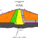
Chami Rokhana dam is a mixed embankment-concrete dam.
The embankment dam typical cross section can be described as follows:
• dam crest elevation: 472.00 (m a.s.l.)
• minimum foundation elevation (core bottom): 441.00 (m a.s.l.)
• upstream and downstream face slopes (vertical/horizontal): 1:3 (-)
• overall embankment volume ~600,000 (m3)
The concrete dam typical cross section can be described as follows:
• Rankine triangle vertex elevation 469.00 (m a.s.l.)
• minimum foundation elevation (cutoff bottom): 438.00 (m a.s.l.)
• upstream face slope (horizontal/vertical) 0,1:1 (-)
• downstream face slope (horizontal/vertical) 0.75:1 (-)
It presents two typical cross section: a nonovertopping cross section (26.30 m) and an overtopping cross section (140.40 m). Nonovertopping cross section, of gravity type, is characterized as follows:
• dam crest elevation: 472.00 (m a.s.l.)
• dam crest width: 5.00 (m) (on the crest, a 4.00 m wide road is obtained)
• overall concrete volume (included outlet, intake and pumping station
~100,000 (m3)
Spillway weir elevation of overtopping cross section, is instead 467.00 (m a.s.l.).
03 Giu 2014
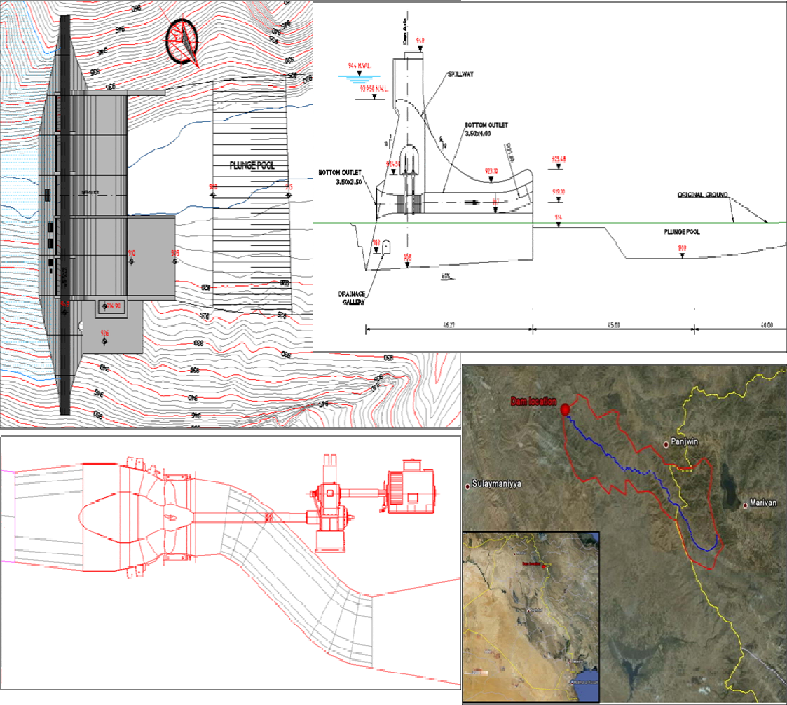
A Contracts for Preliminary and Detailed Design for the construction of a concrete gravity dam in the Region of Iraqi Kurdistan, value of Iraqi Dinars corresponding to about $3,802,611.13, has been awarded in 2011 to HMR Engineering Company, after a public tendering process.
The main features of the work are:
• catchment area 20 km²;
• maximum impounded volume 647,674 m³;
• Dam height 12.00 meters over river bottom;
• length of crest (3.00m wide) 115.00m;
• spillway width 20.00m;
• volume of excavation for dam sections, bottom outlet and spillway and 20,000 m³;
• concrete for the dam, bottom outlet, spillway and various works for 20,000 m³;
• irrigation system with steel pipes of various diameters for a total length of 4,000m;
• access & service road about 2,000m long.

03 Giu 2014
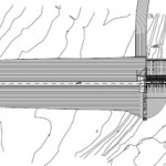
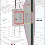
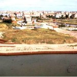
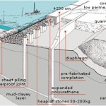
In the Chioggia area, work to secure dumps has involved the former Val da Rio dump created between 1964 and 1984 with dumping of more than 500,000 m³ of waste. Erosion caused by wave motion and wash on the banks, dispersion through the sandy layers and rainwater leaching have led to dispersion of pollutants into the surrounding environment, making the need to secure the 7 ha area a matter of urgency. Work consisted largely of sealing the entire perimeter of the dump by installing a plastic membrane, metal sheet piling or both depending on the characteristics of the various areas. Complementary measures have also been completed to secure the area between the dump and the port.
01 Giu 2014
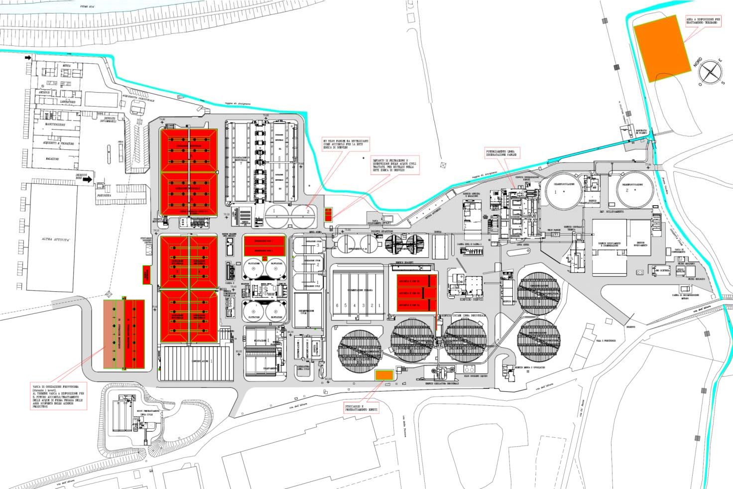
Description of the activities
1 – Strengthening of civil line
Improve Civil capacity that, during rainy period, reaches values in the order of 24,000 – 25,000 m3 / d, with the need to spillway (authorized) in the Canal. New supply of wastewater from Paper Mill Chiampo (active since 2012).
Future contribution (from 2016) to the treatment plant (yet to be determined in which line of treatment) of the first rain water of open areas of the companies listed in Annex F of the PTA.
2 – Optimization of the industrial line
Rationalization of the No. 1 line of the oxidation sector (No. 6 tanks for a total of 56,000 m3) aimed at ensuring safety and energy saving. Tertiary treatment of effluent – Effluent Improvement of SST and Chrome quality. Reuse (partial) of the effluent of the civil line as civil service water for the plant.